Welcome to part two of a nine part series of articles from Mark Barden, our Community Cultural Experience Manager here at Hampshire Cultural Trust, 'digging the dirt' on all things archaeology.
Episode 2: X marks the spot - knowing where to dig
Archaeologists use a variety of methods to build up a picture of what could lie below the ground. This begins with research into the history of a site in advance of any excavation. Historical records, old maps, reports by local antiquarians and objects deposited with museums over the years all help tell the story of a site.
Geophysical surveys
There are many ways archaeologists have of investigating a site that can help locate archaeological deposits below the ground without digging. Together these methods are referred to as geophysical surveys.
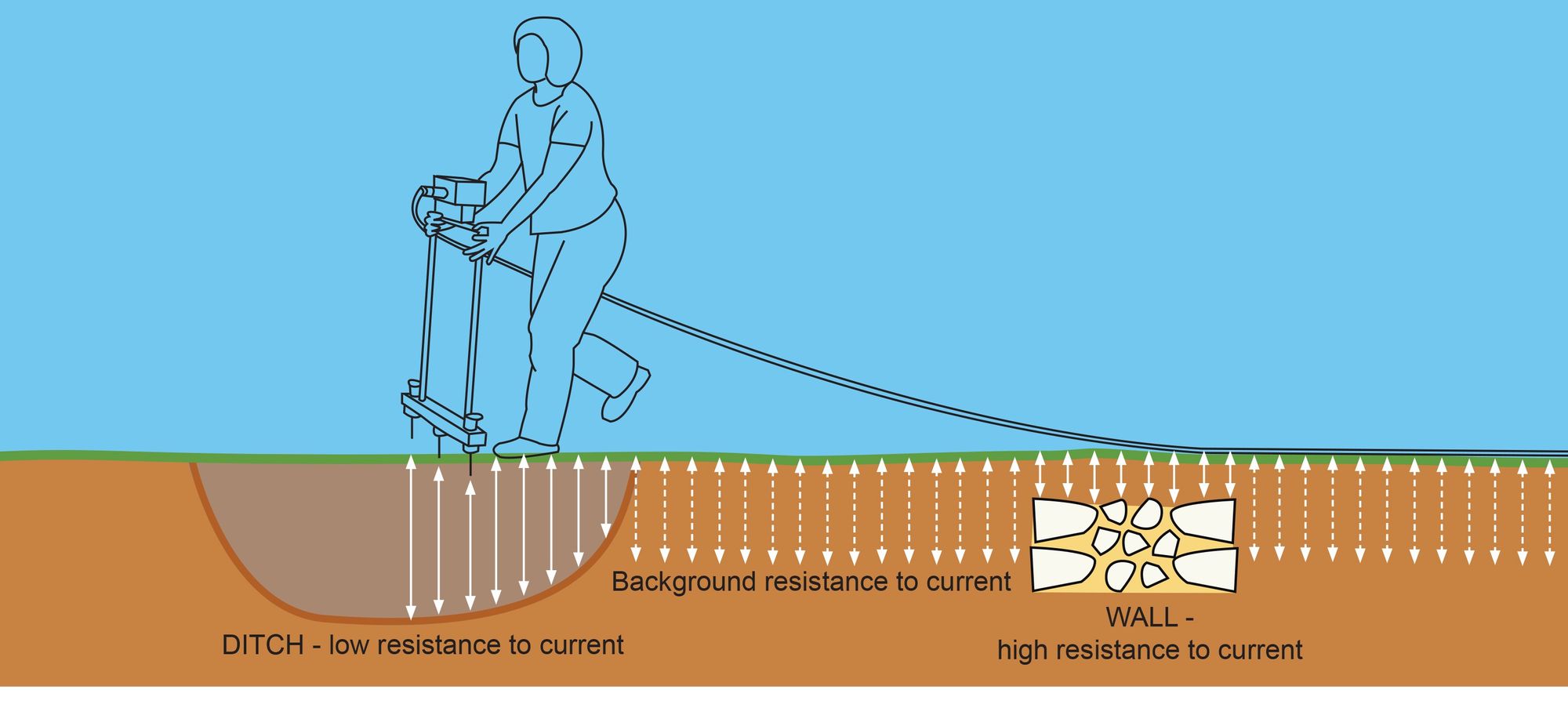
Magnetometers can be used to measure the variations in the magnetism of the soil which can be altered by human activity such as burning. Resistivity measures levels of resistance to an electric current past through the soil. For example, buried stone walls can result in high resistance and ditches filled with disturbed soil offer low resistance.
Ground Penetrating Radar is used to give a three dimensional view of the archaeology below the ground, making it possible to measure the depth of remains, particularly walls and floors.
LIDAR, Light Detection and Ranging, is an aerial survey technique which uses laser light to create a 3D representation of the earth's surface. It can be used to find archaeological features, which may be concealed by dense undergrowth or forest. It strips away the vegetation, revealing hidden earthworks or buildings.
Fieldwalking surveys
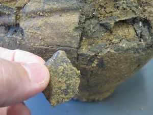
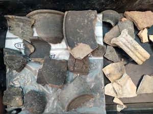
This simply involves walking a gridded area of disturbed ground in sequence, collecting any objects visible on the surface and recording their location. Metal detectors can also play a part in this type of survey. Any objects found are then plotted on a map. Groupings of Roman pottery or tile may, for example, indicate the presence of a Roman building.
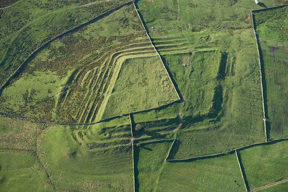
Lumps and bumps
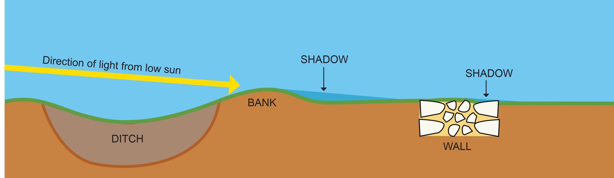
Contour surveys, again based on a grid system, are used to plot different levels in the landscape, revealing banks and ditches (earthworks) by taking spot heights as frequently as every metre across a site.
At certain times of the year earthworks can also be revealed from the air by the exaggerated shadows of low sunlight.
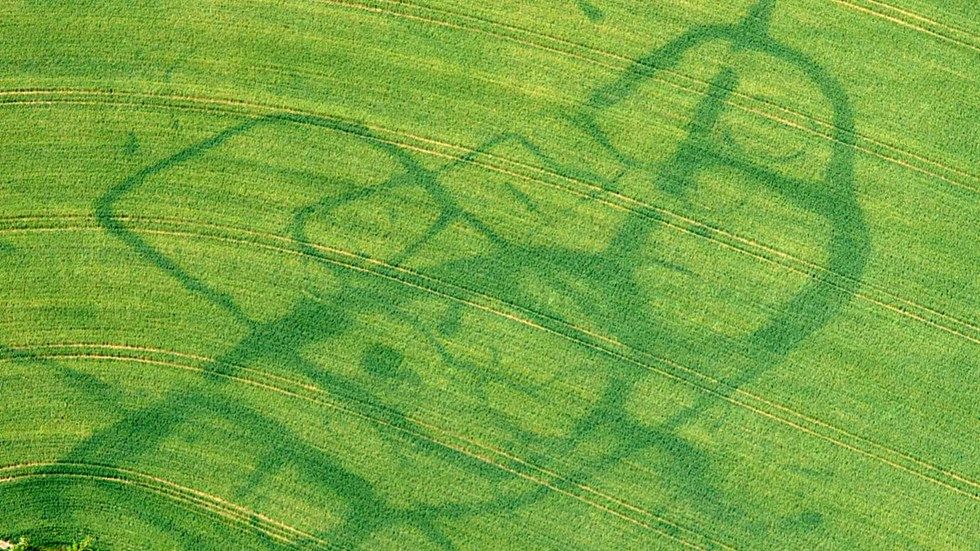
Crop marks and parch marks
Crops planted over a buried wall will grow at a different rate to those planted over a buried ditch and these markings are visible from the air at certain times of year.
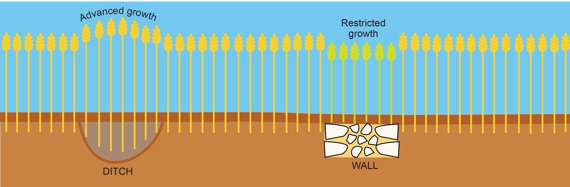
During particularly hot, dry summers buried walls in particular can appear as parch marks in lawns and pasture.
If you have enjoyed Culture on Call and you are able to make a donation, any support you can give will help us keep people connected.